The UAE has released the first high-resolution images captured by its MBZ-SAT and Etihad-SAT satellites, marking a significant step in its growing space capabilities. The release underscores the country’s push to build sovereign Earth observation assets and strengthen its role in global space innovation.

A New Chapter in the UAE’s Space Programme
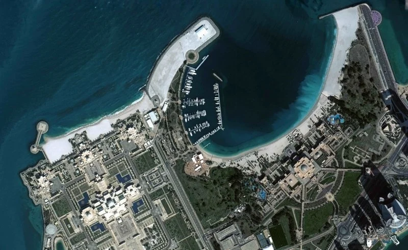
Developed by the Mohammed bin Rashid Space Centre (MBRSC), MBZ-SAT is the most advanced commercial Earth observation satellite in the region. It was designed to provide ultra-sharp imagery that supports sectors such as environmental monitoring, urban planning, disaster response, and infrastructure development.
Etihad-SAT, built in collaboration with local partners, complements MBZ-SAT’s capabilities with broader coverage and rapid data collection, expanding the UAE’s domestic satellite network.
Strengthening Data Sovereignty and Innovation
These two satellites represent a strategic move to ensure the UAE has control over critical geospatial data. By reducing reliance on foreign imagery, the country aims to boost national resilience and support industries ranging from climate research to smart cities.
According to MBRSC, early images show remarkable clarity and precision, reinforcing the UAE’s ambition to become a global hub for space-based Earth observation services.
Beyond National Borders
The data collected by MBZ-SAT and Etihad-SAT will not only support local industries but also offer commercial services to international partners. This positions the UAE as a regional space leader with growing commercial and diplomatic influence.
A Strategic Leap Forward
The successful deployment of MBZ-SAT and Etihad-SAT signals the UAE’s transition from a space exploration participant to a strategic space data provider. As climate and security challenges grow globally, access to real-time, high-quality imagery will play a critical role in shaping economic and geopolitical outcomes.